- Home
- Missions
- Data
- Communications
- People
- The Earth Observer Newsletter
Recent Imagery
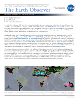
You will be directed to the NASA Visible Earth webpage when you select Images by Mission below, or click on the images at right that are randomly generated to represent four out of all possible topics.
Announcements and Highlights
The Earth Observer: May - Jun, 2010
In This Issue
Click title below to view page
- Editor’s Corner Front Cover
- Feature Articles
- The Origins and Implementation of Operation IceBridge 4
- Arctic Sea Ice News & Analysis: Cold Snap Causes Late-Season Growth Spurt 8
- NASA DEVELOP Students Apply Science and Technology to Public Health 11
- Road Transportation Emerges as Key Driver of Warming in New Analysis from NASA 14
- Blog Log 18
- Meeting/Workshop Summaries
- Earth Observing Missions Applications Workshop Summary 19
- MODIS-VIIRS Science Team Meeting Summary 20
- GRACE Science Team Meeting Summary 23
- In The News
- NASA's GRACE Sees Rapid Spread in Greenland Ice Loss 25
- NASA Satellite Data Helps Everyone Breathe a Little Easier 26
- Regular Features
- NASA Earth Science in the News 28
- NASA Science Mission Directorate – Science Education and Public Outreach Update 30
- Science Calendars 31
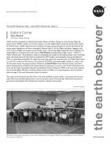
Editor's Corner
Steve Platnick, EOS Senior Project Scientist
NASA recently completed the Global Hawk Pacific Mission (GloPac). Flying out of the Dryden Flight Research Center (DFRC), GloPac was the first mission to use the Global Hawk unmanned aircraft system (UAS) for NASA science. GloPac objectives were to explore trace gases and aerosol patterns, and the dynamics of the remote upper troposphere and lower stratosphere. Between April 2–30, five flights took place, logging a total of 82.5 hours of flight time mostly over the Pacific Ocean. One of these flights lasted 28.6 hours, making it...
Read more...