- Home
- Missions
- Data
- Communications
- People
- The Earth Observer Newsletter


Recent Imagery
You will be directed to the NASA Visible Earth webpage when you select Images by Mission below, or click on the images at right that are randomly generated to represent four out of all possible topics.
The Earth Observer has a new look! Visit the NEW Earth Observer website.
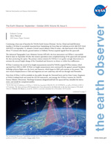
The Earth Observer: Sep - Oct, 2018
In This Issue
Click title below to view page
- Editor’s CornerFront Cover
- Feature Article
- ICESat-2: Measuring the Height of Ice from Space4
- NASA’s DEVELOP Program Recognizes 20 Years of Science Serving Society11
- Meeting Summaries
- An Overview of USGS-NASA Landsat Science Team Activities During 201819
- 2018 CLARREO Science Definition Team Meeting Summary27
- Summary of the Third Surface Water and Ocean Topography Science Team Meeting31
- Summary of the 2018 NASA LCLUC–SARI International Regional Science Meeting35
- Summary of 2018 ASTER Science Team Meeting42
- In The News
- NASA Assists in Efforts to Contain California Wildfires47
- Expedition Probes Ocean’s Smallest Organisms for Climate Answers49
- NASA Investment in Cholera Forecasts Helps Save Lives in Yemen51
- Announcement
- Congratulations to AGU and AMS Award Winners!18
- Fall AGU Comes to DC—Come EXPLORE NASA Science!52
- Regular Features
- NASA Earth Science in the News53
- Science Calendars55
Editor’s Corner
Steve Platnick
EOS Senior Project Scientist
Continuing a busy year of launches for NASA’s Earth Science Division,1 the Ice, Cloud and land Elevation Satellite-2 (ICESat-2) successfully launched from Vandenberg Air Force Base in California at 6:02 AM PDT (9:02 AM EDT) on September 15, aboard a United Launch Alliance Delta II rocket—the final launch of the Delta II. About 75 minutes after launch, ground stations in Svalbard, Norway acquired signals from the spacecraft.
Read more...

