- Home
- Missions
- Data
- Communications
- People
- The Earth Observer Newsletter
Recent Imagery
You will be directed to the NASA Visible Earth webpage when you select Images by Mission below, or click on the images at right that are randomly generated to represent four out of all possible topics.
Announcements and Highlights

You are here
ICESat-2 Mission Brochure
Thumbnail Image:
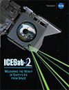
Description:
ICESat-2 will take measurements across the globe and provide an incredibly precise height map of our planet in unprecedented detail. Its focus will be on Earth’s poles, including the Arctic region where temperatures are rising faster than at other latitudes. Read more about how this innovative spacecraft will help scientists check on the health of Earth's frozen regions.
Publication Type:
Year (YYYY):
2 018