- Home
- Missions
- Data
- Communications
- People
- The Earth Observer Newsletter

Recent Imagery
You will be directed to the NASA Visible Earth webpage when you select Images by Mission below, or click on the images at right that are randomly generated to represent four out of all possible topics.
Featured Content
 |
NASA Science Program Support Office 2015 Annual ReportDuring FY2015, the Science Program Support Office (SPSO) supported 24 domestic and international science conferences and public events. Each year the SPSO strives to provide an inspiring and interactive venue, using a unique storytelling approach, that allows a variety of audiences worldwide to connect with NASA Science. The 2015 Annual Report provides a broad overview of these activities, along with details about new Hyperwall stories, publications, social media, key partnerships, and more! |
 |
Observing Snow and Ice Changes from SpaceData from Earth-observing satellite instruments like the Moderate Resolution Imaging Spectroradiometer (MODIS) onboard Terra and Aqua can be used to create maps of snow-cover, ice-cover, and ice-surface temperature. To find out how these datasets are being used, download the three new lenticular flip cards that show Great Lakes ice cover, Greenland ice surface temperature, and North America snow cover from MODIS. |
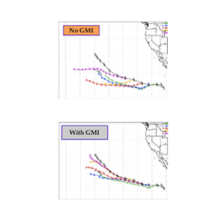 |
GPM Data Help Improve Hurricane Forecast TrackThe GPM mission is now well into its second year and data are flowing in from the Core Observatory and the nine constellation members. In the September-October 2015 issue of The Earth Observer we report on the second GPM Applications Workshop. This meeting was an opportunity to formally introduce the capabilities of GPM to the user community and provide overviews of how GPM data products are being used in a broad range of applications—including an example of how a hurricane forecast track is improved when GPM data are assimilated vs. when GPM data are not used. |
 |
EPIC View of Earth and MoreIn the July-August issue of The Earth Observer, we are happy to report that the Deep Space Climate Observatory (DSCOVR) spacecraft was successfully inserted into its orbit at the first Earth-Sun Lagrange point (L1)—about 1.5 million kilometers (930,000 miles) from Earth—on June 7, 2015. At this time, all instruments are undergoing test and in-flight calibrations during the commissioning phase. Also in the issue, we discuss NASA's Pre-Aerosol, Clouds, and ocean Ecosystems (PACE) mission, which will continue a multidecade record of ocean color measurements. |
 |
Data-Browsing Made Easy: NASA WorldviewLearn how NASA is allowing users around the world to interactively view images created from Earth observations in the May-June 2015 issue of The Earth Observer. Using the Worldview interface, you can access visualizations of data within four hours of when the data were collected—an invaluable tool for land managers, forecasters, or anyone needing near-real-time data to manage ongoing natural events. |
 |
Preliminary Results Revealed!The March-April 2015 issue of The Earth Observer reveals preliminary results from the Integrated Precipitation and Hydrology Experiment (IPHEx) field campaign, held between October 2013 and October 2014 to validate data from the Global Precipitation Measurement (GPM) mission. |
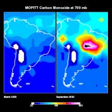 |
15 Things Terra has Taught UsFor more than 15 years, NASA’s Terra spacecraft has enabled new discoveries in Earth System Science. In the January-February issue of The Earth Observer, we provide a sense of what Terra has provided us, and explore 15 findings—on an instrument-by-instrument basis—that are interesting and useful in their own right, and that serve as examples of what Terra has accomplished and will continue to accomplish for years to come! |
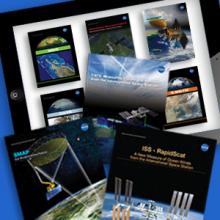 |
iBooks Now Available!Several of our communication publications are now available for download as iBooks. Complete with bold rich colors, interactive content, and other multimedia enhancements, the collection includes the Understanding Earth series of science story booklets (The Icy Arctic, Biodiversity, Biomass Burning, and The Journey of Dust), as well as five in-depth brochures about recently launched Earth-observing missions (Aquarius, OCO-2, ISS-RapidScat, CATS, and SMAP). New iBooks will continue to be added as they become available. Download free copies here. |
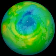 |
Aura Celebrates Ten Years in OrbitJust over ten years ago, the NASA launch and science teams assembled at Vandenberg Air Force Base in California in preparation for the Aura launch. After two delays due to minor problems, on July 15, 2004, shortly after 3:00 AM PDT the Delta II rocket lifted off, carrying the spacecraft toward a polar, sun-synchronous orbit. Still in orbit today, Aura has well exceeded its five-year mission lifetime. The stand-alone feature in the November-December issue of The Earth Observer provides an overview of Aura results over the 10 years since its launch, and acknowledges the work of more than 200 researchers. |
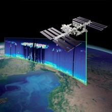 |
CATS: Measuring Clouds and Aerosols from the ISSLaunched January 10, 2015, NASA's Clouds and Aerosol Transport System (CATS) mission provides vertical profiles of cloud and aerosol properties at three wavelengths (1064, 532, and 355 nanometers) from its mounting location onboard the International Space Station. The mission seeks to build on the CALIPSO data record, provide observational lidar data to improve research and operational modeling programs, and demonstrate new lidar retrievals of clouds and aerosols from space. These technologies and the science gained from the CATS mission will be used to design future missions that will study clouds and aerosols and their affects on Earth’s climate and air quality for years to come. |
