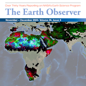
Recent Imagery
You will be directed to the NASA Visible Earth webpage when you select Images by Mission below, or click on the images at right that are randomly generated to represent four out of all possible topics.
NASA's Earth Observing System Project Science Office
NASA’s Earth Observing System (EOS) is a coordinated series of polar-orbiting and low inclination satellites for long-term global observations of the land surface, biosphere, solid Earth, atmosphere, and oceans. As a major component of the Earth Science Division of NASA’s Science Mission Directorate, EOS enables an improved understanding of the Earth as an integrated system. The EOS Project Science Office (EOSPSO) is committed to bringing program information and resources to the Earth science research community and the general public alike.
Download ChartEarth Science Mission Profiles
This website has been designed to cover not just the original Earth Observing System (EOS) missions, but also all of NASA’s Earth-observing satellite missions (many of them joint with other nations and/or agencies), along with other elements of NASA’s Earth Science program. The EOSPSO is funded through the Earth Science Division of NASA’s Science Mission Directorate.
NASA Earth Science Division Operating Missions
Image by Jenny Mottar, NASA Headquarters
Added: March 19, 2013
-
-
-
-
-
-
-
-
-
-
-
-
-
-
-
-
-
-
-
-
-
-
-
-
-
-
-
-
-
-
-
-
-
-
-
-
-
-
-
Aqua (Joint with Japan and Brazil)
-
Launch: May 4 2002
- Altitude:
- 705km
- Inclination:
- 98.20°
- Local Node:
- 1:30 p.m.
-
Aquarius (NASA/Argentina )
-
Launch: Jun 9 2011
- Altitude:
- 657km
- Inclination:
- 98.00°
- Local Node:
- 6:00 a.m.
-
Aura (Joint with Netherlands, Finland, and the U.K.)
-
Launch: Jul 15 2004
- Altitude:
- 705km
- Inclination:
- 98.20°
- Local Node:
- 1:45 p.m.
-
-
CloudSat (Joint with Canada)
-
Launch: Apr 28 2006
- Altitude:
- 705km
- Inclination:
- 98.20°
- Local Node:
- 1:30 p.m.
-
-
-
-
-
-
Landsat 7 (Joint with USGS)
-
Launch: Apr 15 1999
- Altitude:
- 705km
- Inclination:
- 98.20°
- Local Node:
- 10:05 a.m.
-
-
-
-
OSTM/Jason-2 (Joint with NOAA, CNES, and EUMETSAT)
-
Launch: Jan 20 2008
- Altitude:
- 1,336km
- Inclination:
- 66.00°
-
-
-
-
-
-
-
-
-
-
-
-
-
-
-
-
-
-
-
-
-
-
-
-
-
-
-
-
-
-
-
-

