- Home
- Missions
- Data
- Communications
- People
- The Earth Observer Newsletter

Recent Imagery
You will be directed to the NASA Visible Earth webpage when you select Images by Mission below, or click on the images at right that are randomly generated to represent four out of all possible topics.

You are here
Mission Brochures
NASA's Earth Observing System provides a variety of materials available for download. Feel free to choose a category below:
- Brochures
- Postcards
- Posters
- Science Writers’ Guide
- Mission Brochures
- Fact Sheets
- Calendars
- Booklets
- Lithographs
- Reference and Data Products Handbooks
- iBooks
- Activities
|
|
Terra NASA’s Earth Observing System (EOS) began a long-term, comprehensive study of the Earth with a series of satellites specially designed to study the complexities of global change, an advanced computer network for distributing scientific data, and international teams of scientists who are studying the data. In 1999, NASA launched the EOS satellite Terra to begin collecting a new 15-year global data record on which to base future scientific investigations about our complex planet. This is related to the following mission(s): This publication appears in: |
 |
Advanced Spaceborne Thermal Emission and Reflection Radiometer (ASTER) The only instrument flying on the EOS Terra (formerly AM-1) platform that acquires high-resolution images is ASTER. The primary goal of the ASTER mission is to obtain high-resolution image data in 14 channels over targeted areas of the Earth’s surface, as well as black-and-white stereo images. With a revisit time between 4 and 16 days, ASTER provides the capability for repeat coverage of changing areas on the Earth’s surface. This is related to the following mission(s): This publication appears in: |
 |
Multi-angle Imaging Spectroradiometer (MISR) MISR is flying on the National Aeronautics and Space Administration’s (NASA’s) first Earth Observing System (EOS) satellite—EOS Terra (formerly AM-1)—together with four other instruments designed to study Earth from space. The Jet Propulsion Laboratory (JPL) of the California Institute of Technology built the MISR instrument for NASA. JPL, in collaboration with the MISR science team, built the software to convert raw MISR data into information that Earth science researchers can use. This is related to the following mission(s): This publication appears in: |
 |
AERONET (2012) This resource gives a brief overview of the AErosol RObotic NETwork (AERONET) program, which provides a long-term, accessible database of aerosol properties. Long-term commitment to AERONET sites worldwide provides assessment of the regional climatological impact of aerosols (e.g., aerosol amount, size, and heating or cooling effects). Learn more about this international program and how measurements from AERONET help improve our understanding of Earth’s climate. This publication appears in: |
 |
NASA Earth Observations Serving Society (2007) This brochure offers an overview of the NASA Earth Science Applications, which benchmark practical uses of NASA-sponsored observations from Earth observation systems and predictions from Earth science models. NASA implements projects that carry forth this mission through partnerships with public, private, and academic organizations. These partnerships focus on innovative approaches for using Earth science information to provide decision support that can be adapted in applications worldwide. This publication appears in: |
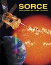 |
SOlar Radiation and Climate Experiment (SORCE) (2002) The SOlar Radiation and Climate Experiment (SORCE) is a small free-flying satellite carrying four scientific instruments to measure the solar radiation incident at the top-of-the-Earth’s atmosphere. This mission is one element of NASA’s Earth Observing System (EOS), which is the major observational and scientific element of the U.S. Global Change Research Program. This publication appears in: |
Pages
- « first
- ‹ previous
- 1
- 2
- 3
- 4