- Home
- Missions
- Data
- Communications
- People
- The Earth Observer Newsletter
Recent Imagery
You will be directed to the NASA Visible Earth webpage when you select Images by Mission below, or click on the images at right that are randomly generated to represent four out of all possible topics.

You are here
Science Communication Material
NASA's Earth Observing System provides a variety of materials available for download. Feel free to choose a category below:
- Brochures
- Postcards
- Posters
- Science Writers’ Guide
- Mission Brochures
- Fact Sheets
- Calendars
- Booklets
- Lithographs
- Reference and Data Products Handbooks
- iBooks
- Activities
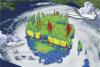 |
NASA Hurricane and Severe Storm Sentinel (2012) Learn how NASA plans to use Unmanned Aircraft Systems (UAS) to study hurricanes and severe storms in the Atlantic Basin. This publication appears in: |
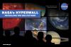 |
NASA's Hyperwall: Revealing the Big Picture (2011) We invite you to explore science at NASA. From the universe, to your backyard, we’ve got something to show you! Wondering what The Big Picture on the front of these two cards is all about? Find out on the other side. For starters, we’ve chosen a few examples of stories you may have seen on NASA’s Hyperwall. But that’s not all, you’ll also find links that allow you to discover extraordinary examples of our changing planet, and watch fascinating visualizations from NASA’s Scientific Visualization Studio. This publication appears in: |
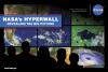 |
NASA's Hyperwall: Revealing the Big Picture (2011) We invite you to explore science at NASA. From the universe, to your backyard, we’ve got something to show you! Wondering what The Big Picture on the front of this card is all about? Find out on the other side. For starters, we’ve chosen a few examples of stories you may have seen on NASA’s Hyperwall. But that’s not all, you’ll also find links that allow you to discover extraordinary examples of our changing planet, and watch fascinating visualizations from NASA’s Scientific Visualization Studio. This publication appears in: |
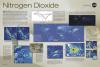 |
Nitrogen Dioxide (2011) Learn about this toxic gas and about some of its primary sources. Did you know that most of the sources of nitrogen dioxide are human-made? Find out how, here! This publication appears in: |
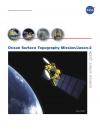 |
Ocean Surface Topography Mission/Jason-2 (2008) The Ocean Surface Topography Mission (OSTM)/Jason-2 advances our understanding of ocean circulation and will improve our ability to forecast climate events and measure global sea-level change. The instruments on board are designed to map ocean surface topography to provide information on ocean wave heights, sea surface topography, tides, and water vapor. OSTM/Jason-2 continues the tasks of the Jason-1 mission. This publication appears in: |
 |
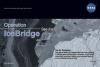
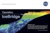
Operation IceBridge (2010) What’s Operation IceBridge all about? This one-pager sums it up, highlighting images and facts that characterize NASA’s six-year airborne mission to monitor Earth’s polar ice sheets, glaciers and sea ice. Display the front of the lithograph to showcase flight lines from the 2010 campaign over Arctic sea ice and Greenland’s land ice. Turn the lithograph over to read about the mission’s science goals, aircraft and instruments. This publication appears in: |
 |
Operation IceBridge Aerial Views of Polar Ice (2010) Send a "note from the field" with a postcard featuring an image from Operation IceBridge, NASA’s six-year airborne mission to monitor Earth’s polar ice sheets, glaciers, and sea ice. Display the front of the card to showcase a spectacular image from the mission. Turn the card over to read factoids and learn about the ice at Earth’s polar regions -- a major factor in the global climate system. Data collected during IceBridge is helping scientists maintain polar observations between NASA’s Ice, Cloud, and land Elevation Satellite (ICESat), which stopped collecting science data in 2009, and ICESat-2, planned for late 2015. The mission is also yielding an unprecedented 3D view of targeted regions of interest, such as the dramatically retreating Jakobshavn Glacier in Greenland. This publication appears in: |
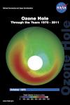 |
Ozone Hole: Through the Years 1970-2011 (2012) This card shows the monthly-averaged total ozone over Antarctica in October of 1970, 1979, 1984, 1989, 2000, and 2011. Also, find out what could have happened to the Earth’s ozone layer by 2063. This publication appears in: |