- Home
- Missions
- Data
- Communications
- People
- The Earth Observer Newsletter
Recent Imagery
You will be directed to the NASA Visible Earth webpage when you select Images by Mission below, or click on the images at right that are randomly generated to represent four out of all possible topics.
You are here
Science Communication Material
NASA's Earth Observing System provides a variety of materials available for download. Feel free to choose a category below:
- Brochures
- Postcards
- Posters
- Science Writers’ Guide
- Mission Brochures
- Fact Sheets
- Calendars
- Booklets
- Lithographs
- Reference and Data Products Handbooks
- iBooks
- Activities
 |
Operation IceBridge Aerial Views of Polar Ice (2010) Send a "note from the field" with a postcard featuring an image from Operation IceBridge, NASA’s six-year airborne mission to monitor Earth’s polar ice sheets, glaciers, and sea ice. Display the front of the card to showcase a spectacular image from the mission. Turn the card over to read factoids and learn about the ice at Earth’s polar regions -- a major factor in the global climate system. Data collected during IceBridge is helping scientists maintain polar observations between NASA’s Ice, Cloud, and land Elevation Satellite (ICESat), which stopped collecting science data in 2009, and ICESat-2, planned for late 2015. The mission is also yielding an unprecedented 3D view of targeted regions of interest, such as the dramatically retreating Jakobshavn Glacier in Greenland. This publication appears in: |
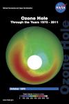 |
Ozone Hole: Through the Years 1970-2011 (2012) This card shows the monthly-averaged total ozone over Antarctica in October of 1970, 1979, 1984, 1989, 2000, and 2011. Also, find out what could have happened to the Earth’s ozone layer by 2063. This publication appears in: |
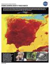 |
Public Health (2005) The spread of chronic and infectious diseases is a serious threat to public health. Research has shown that many chronic and infectious diseases are related to environmental conditions. Organisms such as ticks and mosquitoes (called disease vectors) transport these diseases, and variability in rainfall and temperature has a major influence on the distribution and quantity of these pests. Recent outbreaks of West Nile Virus and other vector-borne diseases have illustrated the importance of having accurate and timely information to predict and respond to epidemics. This publication appears in: |
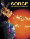 |
SOlar Radiation and Climate Experiment (SORCE) (2002) The SOlar Radiation and Climate Experiment (SORCE) is a small free-flying satellite carrying four scientific instruments to measure the solar radiation incident at the top-of-the-Earth’s atmosphere. This mission is one element of NASA’s Earth Observing System (EOS), which is the major observational and scientific element of the U.S. Global Change Research Program. This publication appears in: |
 |
Sulfur Dioxide (2011) Discover some of the ways in which this important air pollutant is made, through both natural and human-made sources. NASA’s Aura satellite, and others, continually monitor sulfur dioxide in order to help scientists understand its effect on Earth’s natural systems. This publication appears in: |
 |
The SERVIR Program: From Space to Village, Bringing People and Their Environment into Harmony (2011) SERVIR the Regional Visualization and Monitoring System — was started by the National Aeronautics and Space Administration (NASA) and the US Agency for International Development (USAID) in 2005. It provides environmental decision support in multiple regions across the globe using Earth observation and geospatial information. This publication appears in: |
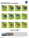 |
Water Management (2005) The Earth is easily distinguishable from other planets in our solar system by the abundance of water on its surface. Water covers approximately 70% of our world’s surface, so it would seem that finding enough water suitable for human consumption, commerce, and ecosystems is a trivial task. But, only 2.5% of the Earth’s water is fresh and of that amount, more than two-thirds is locked away in glaciers and polar ice caps and is not available to for use by society. Therefore, fresh water is actually a limited resource. Increased demand from an ever-growing population threatens to deplete precious water resources. This publication appears in: |
