- Home
- Missions
- Data
- Communications
- People
- The Earth Observer Newsletter
Recent Imagery
You will be directed to the NASA Visible Earth webpage when you select Images by Mission below, or click on the images at right that are randomly generated to represent four out of all possible topics.

You are here
Science Communication Material
NASA's Earth Observing System provides a variety of materials available for download. Feel free to choose a category below:
- Brochures
- Postcards
- Posters
- Science Writers’ Guide
- Mission Brochures
- Fact Sheets
- Calendars
- Booklets
- Lithographs
- Reference and Data Products Handbooks
- iBooks
- Activities
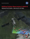 |
Orbiting Carbon Observatory 2 (2014) This brochure describes NASA's Orbiting Carbon Observatory 2 (OCO-2) mission. OCO-2 is the first NASA satellite dedicated to monitoring carbon dioxide, and it will do so with greater precision and detail than current instruments. Data from OCO-2 will help scientists understand where carbon dioxide is being emitted and removed from the atmosphere, subsequently allowing them to make projections of how Earth’s climate might respond to these changes in the future. This is related to the following mission(s): This publication appears in: |
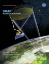 |
Soil Moisture Active Passive (2014) The Soil Moisture Active Passive, or SMAP, mission (described in this brochure) is NASA’s first Earth-observing satellite mission designed to collect continuous global observations of surface soil moisture and freeze/thaw state every 2-3 days at 3 to 40 kilometer (~2 to 25 mile) spatial resolution. As suggested by the name “Active Passive,” SMAP will carry an active microwave radar and a passive microwave radiometer that will measure across a 1000-kilometer (~621-mile) wide swath. The ability to measure global soil moisture and its freeze/thaw state from space with unprecedented accuracy and spatial resolution will allow scientists to better understand the processes that link the Earth’s water, energy, and carbon cycles, as well as enhance the predictive skills of weather and climate models. In addition, scientists can use these data to develop improved flood prediction and drought monitoring capabilities. Societal benefits include improved water-resource management, agricultural productivity, and wildfire and landslide predictions. This is related to the following mission(s): This publication appears in: |
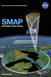 |
Soil Moisture Active Passive, Lenticular (2014) NASA’s Soil Moisture Active Passive (SMAP) mission (described on this lenticular product), scheduled to launch in late 2014, is designed to collect continuous global observations of surface soil moisture and freeze/thaw state every 2-3 days at 3 to 40 kilometer spatial resolution. SMAP will carry an active microwave radar and a passive microwave radiometer that will measure across a 1000-kilometer wide swath. These measurements will allow scientists to better understand the processes that link the Earth’s water, energy, and carbon cycles, as well as enhance the predictive skills of weather and climate models. Scientists can also use SMAP data to develop improved flood prediction and drought monitoring capabilities. This is related to the following mission(s): This publication appears in: |
|
|
World Parks Lenticular Card This lenticular card shows environmental changes inside four National Parks around the world. This publication appears in: |
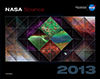 |
2013 NASA Science Mission Directorate Calendar |
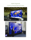 |
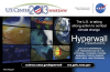
A Guide for Preparing Hyperwall Content If you are a NASA affiliate and need to prepare content for the hyperwall, will be using the hyperwall to deliver a presentation, and/or want to learn more about designing hyperwall layouts, please refer to this guide and discover an easy way to design your hyperwall layout. This publication appears in: |
 |
A-Train Poster The Afternoon Constellation at-a-glance. Download this printable poster that highlighting some of the A-Train's most beautiful and dramatic satellite imagery of Earth's recent events. This publication appears in: |
 |
COP-19 Hyperwall Presentation Schedule This postcard provides the titles, speaker names, and times of the daily NASA hyperwall presentation schedule during the nineteenth session of the Conference of the Parties (COP-19), held November 11-22, 2013, in Warsaw, Poland. This publication appears in: |
 |
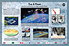
Earth at Night (2012) The Earth at Night poster was created with data from the Visible Infrared Imaging Radiometer Suite (VIIRS) “day-night band” onboard the Suomi National Polar-orbiting Partnership (NPP) satellite. The data were acquired over nine days in April and thirteen days in October 2012. The back of the poster describes how the image was made, how the VIIRS Earth-at-night dataset is used, and includes an interesting facts section and quiz. This is related to the following mission(s): This publication appears in: |
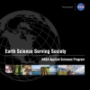 |
Earth Science Serving Society: NASA Applied Sciences Program (2012) The NASA Applied Sciences Program promotes and funds activities that discover and demonstrate innovative uses and practical benefits of NASA’s Earth science resources. By partnering with public and private organizations to apply NASA scientific findings and Earth observing data to decision-making activities, the Applied Sciences Program actively benefits society through Earth science. This publication appears in: |