
You are here
Science Communication Material
NASA's Earth Observing System provides a variety of materials available for download. Feel free to choose a category below:
- Brochures
- Postcards
- Posters
- Science Writers’ Guide
- Mission Brochures
- Fact Sheets
- Calendars
- Booklets
- Lithographs
- Reference and Data Products Handbooks
- iBooks
- Activities
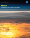 |
CERES FM6 The Clouds and the Earth’s Radiant Energy System, or CERES, instrument measures reflected sunlight and thermal radiation emitted by the Earth. Data products from CERES include both solar-reflected and Earth-emitted radiation from the top of the atmosphere to the Earth’s surface. These measurements, called radiative fluxes, represent the amount of energy radiated through a given area within a given time range. CERES provides the only global top of atmosphere energy budget dataset. In addition, the CERES science team uses measurements from a high spatial resolution visible/infrared imager flying alongside CERES to infer a variety of cloud properties, including cloud amount, altitude, thickness, and the size of cloud particles. Data from CERES FM6 will help scientists further develop a quantitative understanding of the links between the Earth’s energy budget and the properties of atmosphere and surface that define it. This is related to the following mission(s): This publication appears in: |
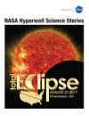 |
Eclipse Hyperwall Science Stories On Monday, August 21, 2017, all of North America will be treated to an eclipse of the sun. Anyone within the path of totality can see one of nature’s most awe inspiring sights—a total solar eclipse. This path, where the moon will completely cover the sun and the sun’s tenuous atmosphere—the corona—can be seen, will stretch from Salem, Oregon to Charleston, South Carolina. Observers outside this path will still see a partial solar eclipse where the moon covers part of the sun’s disk. This brochure contains high-definition visualizations related to the eclipse, past eclipses and transits, and our sun. This publication appears in: |
 |
NASA Earth Observations: Quick Tools Quick tools to explore Earth science concepts. This publication appears in: |
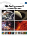 |
NASA Hyperwall Science Stories This brochure represents some of the science stories available on NASA’s Hyperwall. This publication appears in: |
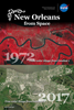 |
New Orleans from Space Postcard of New Orleans, LA. The top image is a 1972 false color Landsat 1 scene of New Orleans, LA that uses green, red, and infrared wavelengths to highlight vegetation in red. Advances in space imaging over the past four and a half decades allow sensors to record more wavelengths. Today, true color Landsat 8 scenes, such as the one shown in the bottom image, look like photographs from space. This is related to the following mission(s): This publication appears in: |
 |
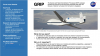
Seadler - GRIP Results One-Pager NASA’s Genesis and Rapid Intensification Processes (GRIP) experiment studied the physical and environmental factors that contribute to hurricane formation and intensification. The experiment sought to answer 1) What environmental and inner-core processes determine whether a storm will strengthen into a hurricane? And 2) To what extent can we predict whether this intensification will occur? From 15 August through 30 September 2010, NASA flew three aircraft carrying fifteen instruments over the Atlantic Ocean and Gulf of Mexico to measure vertical and horizontal wind speeds, precipitation, pressure, temperature, and humidity in and around tropical cyclones in an attempt to figure out what fuels the powerful storms. This publication appears in: |
 |
Seadler - GRIP Results Slide The Genesis and Rapid Intensification Processes (GRIP) campaign studied the physical and environmental processes that affect the lifecycle of Atlantic hurricanes from formation to dissipation. This publication appears in: |
 |
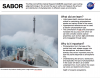
Seadler - SABOR Results One-Pager NASA’s Ship-Aircraft Bio-Optical Research (SABOR) experiment used cutting-edge technology in the air and the sea to verify and measure the amount, type, and distribution of phytoplankton in different ocean environments. The field campaign sought to answer whether new technologies, such as lidar and polarization, could be used to better observe changes in oceanic ecosystems. From 17 July to 17 August 2014, the SABOR campaign took in situ, ship-based above-water, and airborne measurements of phytoplankton content, particulate matter, and oceanic optical properties. The campaign sought to cover a broad range of oceanic environments—from optically complex coastal waters to clear blue open ocean—for maximum accuracy. This publication appears in: |
 |
Seadler - SABOR Results Slide The Ship-Aircraft Bio-Optical Research (SABOR) experiment used cutting edge technology in the air and the sea to verify and measure the amount and distribution of phytoplankton in different ocean environments. This publication appears in: |
 |
Seadler - SEAC4RS Results One-Pager NASA’S Studies of Emissions and Atmospheric Composition, Clouds, and Climate Coupling by Regional Surveys (SEAC4RS) campaign studied how aerosols are injected into and influence upper tropospheric and lower stratospheric composition and chemistry. The campaign sought to answer: − How does deep convection distribute aerosol particles and gases, including pollutants, in the atmosphere? − How do gases and aerosols influence atmospheric chemistry and climate? During multiple regional flights across the southeastern and southwestern United States, NASA incorporated measurements from satellites, research aircraft, weather balloons, and ground sites to measure atmospheric convection, composition, and chemistry. In particular, SEAC4RS examined the role of pollution, large urban centers, agricultural fires, and areas of intense isoprene emissions in the southeastern United States, as well as wildfires and the North American monsoon in the southwestern United States. This publication appears in: |